In pursuit of enhancing safety and infrastructure resilience, the Centre for Tropical Geoengineering (GEOTROPIK) at Universiti Teknologi Malaysia (UTM), with Associate Professor Ir Dr Ahmad Safuan A Rashid as the project leader, has embarked on a significant research initiative to address the issue of landslide risk mitigation.
SUKE Highway, managed by Prolintas Sdn Bhd, a vital intra-urban elevated thoroughfare in Kuala Lumpur, traverses challenging terrain, making it susceptible to landslide occurrences, especially given the evolving climate dynamics. With a history of minor landslides near its vicinity, the highway’s vulnerability demands proactive monitoring and mitigation measures.
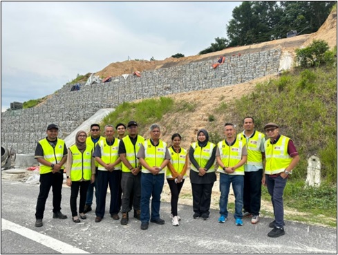
Prolintas Sdn Bhd has granted a comprehensive assessment project of “Establishment of Rainfall Threshold Model for Slope Stability in Sungai Besi-Ulu Kelang Elevated Expressway (SUKE)” to GEOTROPIK which the work commenced with a kick-off meeting in March 2024. The multidisciplinary UTM team, consisting of expertise spanning disciplines of Slope Engineering, Survey, GIS, Geotechnics, and Sensor Technology, conducted an initial site visit on April 17, 2024

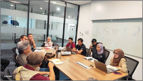
A meeting between Prolintas Sdn Bhd and the representative’s team from UTM.
A crucial aspect of the research involves establishing rainfall thresholds as a predictive tool for slope failure. Given Malaysia’s distinct rainfall patterns influenced by monsoon seasons, it is paramount to understand the relationship between rainfall characteristics and slope instability.
According to Dr Ahmad Safuan, the team will utilise advanced simulation software to scrutinise short and prolonged rainfall events to delineate critical thresholds.
“We will comprehensively assess landslide risk and the team has identified twelve causative factors: stream power index, vegetation index, topography, lithology, land use, and proximity to roads, faults, and rivers. Leveraging available data sets, the team aims to develop hazard, risk, and vulnerability maps to identify elements at risk along the SUKE Highway.”
“Furthermore, the project entails deploying a real-time slope monitoring system in key catchment areas to monitor rainfall intensity and its impact on slope stability. This proactive approach will enable authorities to implement timely interventions and enhance disaster preparedness.”
The project is scheduled for completion by February 2025, which signifies a collaborative effort to deliver actionable insights to safeguard infrastructure and communities. The UTM team remains committed to fostering interdisciplinary collaboration and delivering outcomes that benefit stakeholders and society at large.

The site visit took place on April 17, 2024, to conduct an initial assessment and facilitate subsequent planning stages.
