

Linggi, Negeri Sembilan, June 3, 2023 – In a remarkable collaboration, Universiti Teknologi Malaysia (UTM) and the Kg. Sg. Timun community have united once again to conduct a highly successful Corporate Social Responsibility (CSR) programme. Led by Dr. Shahabuddin Amerudin from the Geoinformation Programme in the Faculty of Built Environment and Surveying, this initiative aims to preserve the natural beauty of the mangrove forest ecosystem. The programme showcases the exceptional capabilities of the Mangrove Forest Tree Identification and Geotagging mobile app, with the website https://www.kstutm.com serving as a central hub for accessing information and utilizing the online database and web mapping application developed under the Knowledge Transfer Programme – Research Innovation Grant (KTP-RIG) from CCIN UTM.
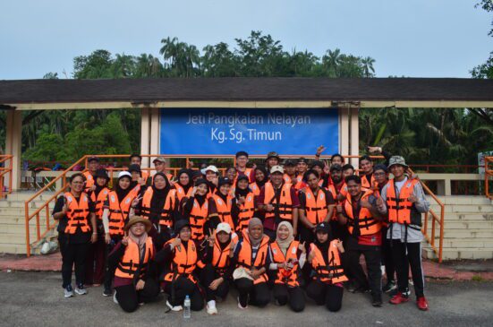
The CSR programme welcomed 33 dedicated third-year Bachelor of Science in Geoinformatics students as its main participants this year. Building upon the valuable experience gained from the previous year’s programme, which involved 21 active student contributors, these passionate individuals were enrolled in the SBEG3583 GIS Software System course. Leveraging their knowledge and skills, they enthusiastically embraced the mobile app as a powerful tool for collecting and storing essential data. The app was also employed during the Lestari Alam Sungai Timun programme on November 2, 2021, joined by various government departments in the Rembau District and coordinated by the Rembau District Office.

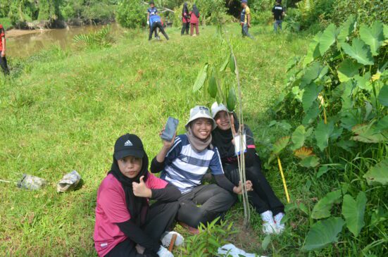
Under the guidance of Prof. Ir. Dr. Mohd Fadhil Md Din from Campus Sustainability UTM, Assoc. Prof. Dr. Zulhilmi Ismail from the Center for River and Coastal Engineering UTM, and with the support of enthusiastic volunteers from the ARC Club UTM, the participants embarked on an extraordinary journey. The programme encompassed various activities, including geotagging 126 trees and successfully planting over 40 mangrove tree seeds. Additionally, existing mangrove trees in the vicinity of Kg. Sg. Timun were meticulously geotagged, contributing to a comprehensive database for monitoring and conservation efforts. The students gained practical expertise in mangrove tree planting, geotagging, tree data collection, and online database management, which will serve them well in their future careers.

The program activities included captivating boat excursions that transported participants to remarkable destinations. Among these memorable journeys were visits to Sabak Arang and Taman Lokan at Kg. Paya Lebar. With the waterways as their path, participants embarked on a voyage of discovery, witnessing the traditional production of charcoal at Sabak Arang and exploring Taman Lokan, a sanctuary for lokan collected from the mangrove forest of Sg. Linggi. These boat-based expeditions added an element of adventure and fostered a profound connection with the natural environment, deepening their understanding of the significance of mangrove conservation.
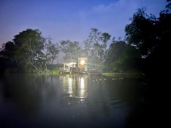
Undoubtedly, a standout moment of the program unfolded during the enchanting excursion along Sg. Rembau, where participants were treated to a captivating display of fireflies illuminating the night sky. These ethereal creatures sought refuge in the majestic Berembang trees, which were also geotagged as part of this remarkable undertaking. The experience etched an indelible mark on the participants, evoking a deep sense of awe and reverence for the magnificence of the natural world. It served as a poignant reminder of our ecosystem’s delicate beauty and interdependence, inspiring a renewed commitment to its preservation.
Reflecting on their experiences, the students provided valuable feedback for improving the mobile app. They suggested enhancing the app’s offline functionality to enable seamless data collection in areas with limited or no internet connectivity. Additionally, they recommended incorporating a more intuitive user interface and streamlining the data synchronization process to optimize efficiency.

Through collaboration between academia, local communities, and technology, lasting positive change has been achieved. The Mangrove Forest Tree Identification and Geotagging mobile app, together with the online database and web mapping application, have proven to be invaluable tools in the conservation and monitoring of mangrove forests. By leveraging these innovative solutions and incorporating the students’ feedback, the programme raised awareness about the importance of mangrove ecosystems. It empowered the local community to actively participate in their preservation.
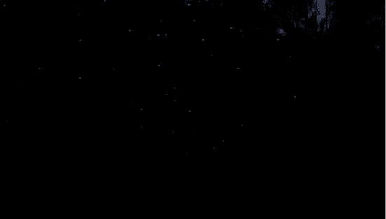
For those fortunate enough to have witnessed the mesmerizing display of fireflies along Sg. Rembau, the experience was nothing short of magical. The sight of these tiny bioluminescent creatures dancing among the Berembang trees is a testament to the wonders of nature. We invite others to venture forth and experience this awe-inspiring spectacle firsthand, as it serves as a reminder of the importance of preserving our natural heritage.
Overall, the UTM and Kg. Sg. Timun’s CSR programme has proven to be successful in empowering mangrove conservation. The involvement of dedicated students, the utilization of innovative technology, and the collaboration with the local community have resulted in valuable outcomes for preserving the mangrove forest ecosystem. The programme has provided practical skills and knowledge to the students and fostered a deeper appreciation for the interconnectedness of the natural environment and the significance of community engagement. With continued efforts and improvements based on the students’ feedback, the programme will continue to make a positive impact on the conservation of mangrove forests for generations to come.