
Author: Muhamad Uznir Ujang
Globally, the Covid-19 pandemic has restricted daily human activities, including Malaysia, where numerous initiatives have been launched to halt the spread of the pandemic since it began. The Malaysian government has taken several significant measures: the Movement Control Order (MCO). The majority of sectors, including business, recreation, and tourism, were temporarily closed to contain the spread of this pandemic (not applicable to the essential services sector). As a result, some citizens were adversely affected (i.e., job loss, affected income). Likewise, the Malaysian government is concerned and making every effort to channel various forms of assistance to the people who have been affected.
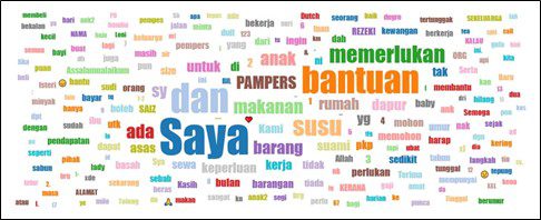
Nonetheless, some people requirde assistance in the form of financial aid or food supplies. Numerous social media posts depicted Malaysians who need help from concerned Malaysians, and these posts have accumulated in number. There was also a campaign to have a white flag flown in front of any home that needs help. However, the assistance sought by these individuals was not successfully delivered due to a lack of complete information about the housing unit. Moreover, the MCO restricted citizens’ movement within a 10-kilometre radius of their homes. Due to the scarcity of information about homes needing assistance (based on social media posts), aid was inefficiently delivered.
The presence of geospatial technology applications can aid in the resolution of this problem. During this pandemic, several geospatial applications were developed. Among these is the myBantu application, which was created to aid the Malaysia Bantu campaign. The myBantu application was created by Ts. Dr. Muhamad Uznir Ujang. Dr. Muhamad Uznir Ujang is the Head of the 3D GIS Research Group at Faculty of Built Environment and Surveying, Universiti Teknologi Malaysia (UTM).M).
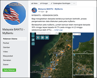
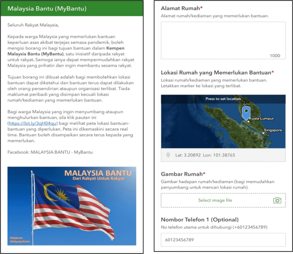
A simple online form (https://arcg.is/1mK5zn0) was all those users require for the myBantu application. The user’s current GPS location was then automatically recorded. Additionally, the user was required to photograph the house to facilitate the delivery of assistance by individuals wishing to assist the user. On the other hand, the myBantu application did not collect personal information because users of the myBantu application can delete previously entered records to avoid duplication of assistance. Successfully filled forms were displayed in real-time on the myBantu map (https://bit.ly/3qH04qu).
Over 1,200 records were added to the myBantu application during the first two weeks of its use. While there were many myBantu locations recorded, what matters most is the assistance delivered to those locations. Therefore, various mediums were used to communicate this information to interested parties. The myBantu application was shared not only with those in need, but also with those who wished to channel assistance.
Following a month of the Malaysia Bantu campaign, we can see a weekly decline in the number of myBantu locations. This demonstrates that by utilising the myBantu application’s map, individuals and relevant NGOs can channel assistance to myBantu locations more effectively and efficiently. It also demonstrates Malaysians’ concern for those who are struggling from the pandemic. This admirable effort should be commended; myBantu’s geospatial applications merely aid in the efficient delivery of information. Without these selfless individuals, the goal of assisting those in need is unlikely to be achieved.
As most of Malaysia’s states have entered the national recovery phases, restrictions on movement within a 10-kilometre radius have also begun to be lifted. Furthermore, the people’s economy is now recovering. In addition, beginning in early October 2021, the locations requiring assistance in the myBantu application are seen to decrease. This indirectly indicates a positive trend in Malaysians’ economic development.
As previously stated, there are other geospatial applications developed during this pandemic. It inevitably serves the same purpose, which is to assist these Malaysians in need. Geospatial applications, such as the myBantu application, effectively streamline the process of delivering assistance to individuals in need. Aside from that, it can determine the state’s economic growth trend through further scientific investigation.